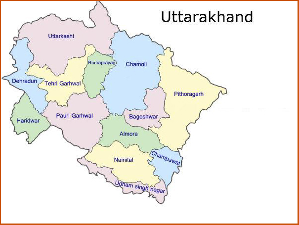


Uttarakhand state is the 27th state of India, which came into existence on 9thNovember, 2000. With a total area of 53483 km2 or 10.3% of the total geographical area of the Himalaya, is inhabited by 8.5 million persons living in 16583 villages and 86 urban centres. Uttarakhand state lies between latitudes 28o7´-31o4´N and longitudes 77o7´-81o1´E extending from river Tons in the west to river Kali in the east. The northern limit is demarcated by Indo-Tibet water divide, while in the south, lie Ganga plains of Uttar Pradesh state. Uttarakhand is largely a rugged mountainous region, where the altitudes dramatically fluctuate between 300m to 7817m (Nanda Devi). As a result, high mountain ridges and deep river valleys are the common features in the mountain area, and great plain in the southern part of the state. This abrupt altitudinal variation has obviously resulted in a complex but interesting diversity in topography, meteorology, flora, fauna, demography, etc. The entire state is constituted by 6 physiographic regions, (from south to north) - Tarai-Bhabar, Shiwalik, Lesser Himalaya, Great-Himalaya and Trans-Himalaya.